Browse Items (1611 total)
| Thumbnail | Title | Description | Date | Date Added |
|---|---|---|---|---|
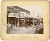 |
1898 Photograph of Tuxhorn's Tent at Free Street Fair in Edwardsville, IL | 1898 photograph of Tuxhorn's Tent at a free street fair, in Edwardsville, Illinois. A man stands in front of the merchandise dressed in a suit and a hat. The tent covers an assortment of wheeled products. | 1898-10-12 - 1898-10-15 | October 2, 2025 |
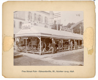 |
1898 Photograph of E. A. Keller Co. Tent at Free Street Fair in Edwardsville, Illinois | 1898 photograph of E. A. Keller Co. Tent at Free Street Fair in Edwardsville, Illinois. Four men in suits and hats stand in front of the tent which is covering buggies, chairs, and more. The tent sits atop a dirt road beside a larger building. | 1898-10-12 - 1898-10-15 | October 2, 2025 |
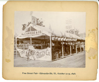 |
1898 Photograph of Wm. C. Kriege & Co. Tent at Free Street Fair in Edwardsville, Illinois | 1898 photograph of WM. C. Kriege & Co. tent at a free street fair, in Edwardsville, Illinois. The tent displays a variety of goods including buggies, bicycles, and stoves. | 1898-10-12 - 1898-10-15 | September 30, 2025 |
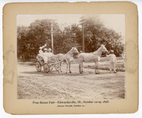 |
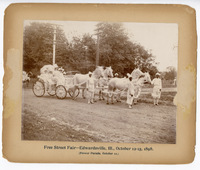
1898 Photograph of Two Women and Man Riding in a Carriage in the Free Street Fair Flower Parade in Edwardsville | This 1898 photograph shows two unknown women and one unknown man riding in a carriage covered in flowers. The carriage is pulled by two white horses that are attended by two unknown men. This carriage was part of a flower parade held in Edwardsville, Illinois, on October 12, 1898, as part of a week-long Free Street Fair. | October 12, 1898 | September 30, 2025 |
 |
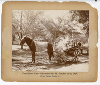
1898 Photograph of Julia Hadley, Mary Hadley, Florence Brink, Mrs. E. I. Prickett in a Carriage, and Four Men Standing during the Free Street Fair Flower Parade | This 1898 photograph shows Julia Hadley (driving), Mary Hadley, Florence Brink, and Mrs. E. I. Prickett riding in a carriage covered in chrysanthemums. The carriage is pulled by four white horses with four unknown men in white costumes handling the horses. This was during the flower parade that was part of Edwarsdville, Illinois's Free Street Fair on October 12, 1898. | October 12, 1898 | September 30, 2025 |
 |
1898 Photograph of Three Women and a Young Girl in a Carriage in the Edwardsville Free Street Fair's Flower Parade | This 1898 photograph shows three women and a young girl riding in a carriage pulled by a horse. The women are dressed in formal attire and the carriage is adorned with flowers. This was part of a flower parade held in Edwardsville, Illinois, during a Free Street Fair in October 1898. | October 12, 1898 | September 30, 2025 |
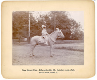 |
1898 Photograph of a Boy Dressed as a Herald in a Parade during Edwardsville's Free Street Fair Flower Parade | 1898 photograph of a boy, likely Edward West Hadley, riding a horse. The boy is dressed as a herald and wearing all white. The horse is wearing flowers. This was part of a flower parade held during an 1898 free street fair in Edwardsville, Illinois. | October 12, 1898 | September 29, 2025 |
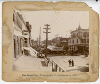 |
1898 Photograph of Main Street in Edwardsville, Illinois, Showing Utility Poles and Street Fair Tents | 1898 photograph taken from a second story showing tents on Main Street of Edwarsdville, Illinois, during a Free Street Fair. The E. A. Keller Co. tent is visible. | October 1898 | September 29, 2025 |
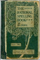 |
The Rational Spelling Book, 1898, owned by Alton Resident Viola Thompson | This 1898 spelling book, "The Rational Spelling Book, Part II" was owned by Alton resident Viola Thompson, whose name is handwritten on the book's front pastedown. The book is intended for fourth grade students and older and may have been used in an Alton classroom. The book includes numerous words for spelling practice and spelling rules from the late 19th century. This book was scanned as part of a Madison Historical class visit to Civic Memorial High School in spring 2019. It was brought to class by Hana Harlan. |
1898 | May 21, 2019 |
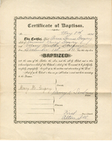 |
Certificate of Baptism for Anne Louise Gregory, December 1, 1898 in Alton | This is a certificate of baptism for Anne Louise Gregory (b. 1893) on December 1, 1898 in Alton. She was the daughter of Samuel Henry Gregory and Mary Martha Gregory and was baptized by Pastor Henry K. Sawborne. | 1898 | March 15, 2019 |
