 |
Pat Childers Oral History Interview |
In this oral history interview, Pat Childers describes her experiences during the Great Flood of 1993 while living in West Alton, Missouri. Following the flood, she and her family moved to Collinsville, Illinois, which she describes. She also discusses growing up on a farm in Southern Missouri. |
December 11, 2016 |
February 7, 2017 |
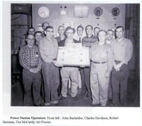 |
Paper Print of Power Station Operators at Standard Oil |
This is a black and white photograph printed on cardstock. The bottom of the image is labeled "Power Station Operators: From left - John Bacheldor, Charles Davidson, Robert Hartman, Tim McCarthy, Art Proctor." |
Circa 1950 |
October 24, 2018 |
 |
Panoramic Photo of the Illinois Glass Company |
This panoramic photo shows works of the Illinois Glass Company in 1897 |
August 6, 1897 |
November 15, 2016 |
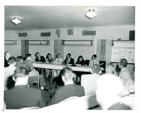 |
Panel Presenting on Catalytic Cracking Units |
This is a black and white photograph of six people at a table with a "Fluid Catalytic Cracking" sign behind them. As part of the 50th anniversary celebration for Standard Oil Company, the company conducted several community outreach educational programs and panels in 1957. |
1957 |
October 30, 2018 |
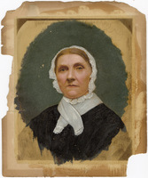 |
Painting of portrait of an unknown woman in black with a white bonnet |
A mounted portrait painting of an older woman wearing a lace-edged bonnet with a small white scarf with lace ends crossed around her neck. The woman wears a large black dress. The painting seems to have been done in the shape of an oval. |
Unknown |
October 2, 2025 |
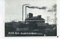 |
Outside view of coal mine #2 in Glen Carbon, Illinois |
This photograph shows coal mine #2 in Glen Carbon |
Unknown |
December 8, 2016 |
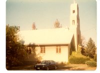 |
Outside View of Church |
Outside view of church |
Unknown |
December 8, 2016 |
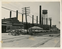 |
Outside the Owens-Illinois Glass Factory |
This photograph of the Owens-Illinois Glass Factory was taken from the entrance by the railroad tracks. |
Unknown |
November 15, 2016 |
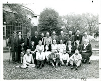 |
Outdoor Group Photograph of Men and Women |
This is a black and white group photograph of 25 men and women standing outdoors, they are likely Standard Oil employees. |
Unknown |
November 12, 2018 |
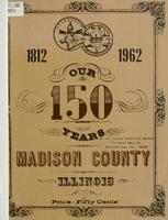 |
Our 150 Years: 1812 - 1962. Madison County, Illinois |
|
1962 |
September 6, 2017 |


