Great River Road, 2016

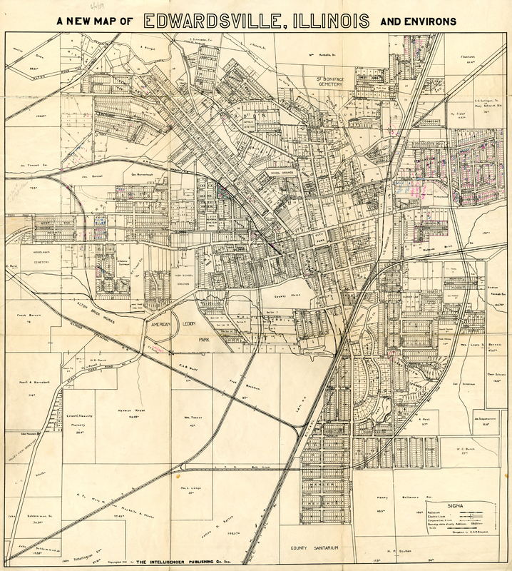
1931 Plat Map of Edwardsville

Citation

Benedict, C. A. R., “1931 Plat Map of Edwardsville,” Madison Historical, accessed November 21, 2024, https://madison-historical.siue.edu/archive/items/show/598.

Rights

The content of Madison Historical: The Online Encyclopedia and Digital Archive is publicly available for use in research, teaching, and private study. Encyclopedia articles, oral histories, web design, and other content original to Madison Historical are licensed under a Creative Commons Attribution-NonCommercial-ShareAlike 4.0 International License. Images in encyclopedia articles not part of the digital archive are either in the public domain or Madison Historical received use permission by the original creators. While in most cases Madison Historical received permission to publish archive items from the institution or individual who possessed the item, it has not determined their copyright status. Please contact the possessing institution or individual for additional information regarding copyright status.

Description

This map of Edwardsville was published in 1931 by the Edwardsville Intelligencer. It shows the property boundaries and owners that existed in the town at the time, as well as various town landmarks such as Lusk Memorial Cemetery Park (today Hotz Park), St. Boniface Cemetery, the courthouse, the Lincoln School, the Madison County Tuberculosis Sanitarium, and Legion Park. It also shows the village of Leclaire. The map was draughted by C. A. R. Benedict.

Subjects

  • government
  • Edwardsville
  • map

Creator

Benedict, C. A. R.

Publisher

Edwardsville Intelligencer

Contributor

  • Jenkins, Paul

Date

1931

Relevant Encyclopedia Article

Language

English

Type

  • Miscellaneous Document

Format

  • Black and white plat map
  • jpg

Coverage

  • Edwardsville, Illinois
  • 1930s

Identifier

  • Jenkins-Paul-D-0001
We are always committed to accuracy in our articles and archive items. If you notice a mistake or have a suggestion, please contact us.