 |
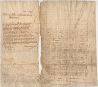
Original 1818 Town Plan of Alton by Rufus Easton |
This town plan for Alton was plotted by St. Louis resident and Missouri territory delegate Rufus Easton in 1817. He named the town in honor of his son, Alton R. Easton. This plat also shows Langdon, Alby, and George streets, which Easton likely named after some of his other children. According to writing on the plat, Rufus Easton signed and delivered the plat on January 1, 1818. It was then approved on March 26, 1818 by John T. Lusk, a justice of the peace for Madison County. There are two copies: the first is on cloth; the second on paper. The map shows the property divisions of the town, including which properties were already sold. The edge of the Mississippi River is also visible, on which the river landing is planned and a promenade set aside for common use. |
January 1, 1818 |
March 10, 2017 |
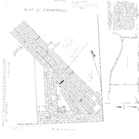 |
1825 Plat Map of Edwardsville |
This 1825 plat map of Edwardsville shows the property divisions in the town along Main Street, Second Street, Third Street, Fourth Street, and Randle Street. The original court house is visible, as is a public cemetery. A second survey of a property in Foster Township is also on the same page. |
December 29, 1825 |
March 10, 2017 |
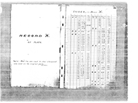 |
1834 to 1857 Plats of Madison County by County Surveyor Benaiah Robinson |
These three volumes were created in 1915 by Madison County Recorder John Berner, who copied the original record books created by Madison County Surveyor Benaiah Robinson and his staff. The original plats were drawn during Robinson's time as county surveyor in the 19th century. The earliest plat is from 1834 (page 74 of Book B), and the latest plat is from 1857 (page 244 of Book B). |
1834 - 1857 |
May 8, 2017 |
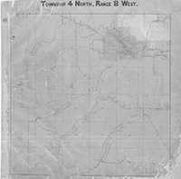 |
1869 to 1871 Road Plats of Madison County by Surveyor Don Alonzo Spaulding |
These road plats were created by Don Alonzo Spaulding from 1869 to 1871. On March 25, 1869, Spaulding was employed by the county court of Madison County to survey all state and county roads in Madison County for public record. The plats were completed by 1871, and the county court approved them as legal evidence on September 14, 1871. The plats were to be kept in the county clerk's office. Today, they are located in the office of the Madison County Recorder. The plats were used as evidence in a 1879 civil suit between The Edwardsville Railroad Company and Seth T. Sawyer. |
1871 |
May 15, 2017 |
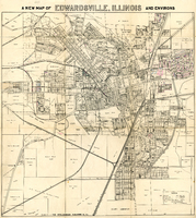 |
1931 Plat Map of Edwardsville |
This map of Edwardsville was published in 1931 by the Edwardsville Intelligencer. It shows the property boundaries and owners that existed in the town at the time, as well as various town landmarks such as Lusk Memorial Cemetery Park (today Hotz Park), St. Boniface Cemetery, the courthouse, the Lincoln School, the Madison County Tuberculosis Sanitarium, and Legion Park. It also shows the village of Leclaire. The map was draughted by C. A. R. Benedict. |
1931 |
September 7, 2017 |


